


Omar Álvarez, Head of intelligent video of cinfo, participates in the I Technical Forum of the Civil UAVs Initiative, the initiative of the Xunta de Galicia for the use of unmanned aerial systems (UAVs) in the civil field and in the improvement of the provision of public services. On Thursday 7 March, cinfo presented its technological solution to improve the quality of recorded images thanks to reprojection and orthorectification.
The I Technical Forum of the Civil UAVs Initiative will turn the Aerodrome of Rozas (Castro de Rei) and the Superior Polytechnic School of the USC (Campus of Lugo) into the scientific and technical meeting point of all the community involved in the aerospace pole of Galicia. The agents participating in the initiative will present their projects in order to get to know, debate and exchange knowledge on relevant technical issues.
cinfo will present at the Forum its solution for the reprojection and orthorectification of aerial images already installed in manned aerial systems. cinfo‘s software converts an aerial image into a cartographic plane capable of faithfully reproducing the terrain regardless of the orography.
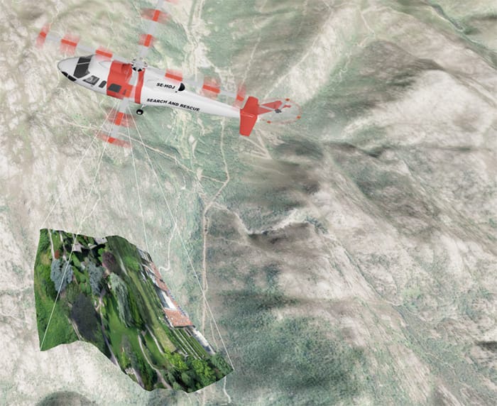
The video solution incorporates an orthorectification tool capable of eliminating distortions in the recorded images that, after processing them with our software, are converted into a detailed photograph, but with cartographic precision and invariable scale of a map.
To get this result, cinfo‘s software uses location and orientation parameters of the aircraft along with the orientation parameters of the camera used. With this data, the image is projected on a 3D representation of the terrain and the necessary calculations are made to obtain the orthorectified image.